

Laser Measurement Tool
The Laser Measurement Tool [LMT] is a very simple tool to measure distances up to 100m for solid walls and 40m to power lines or soft targets such as vegetation.
Once mounted in a scenario, indoor or outdoor, it measures 2D profiles in a matter of seconds.
The main sensor is a 360º laser scanner designed for obstacle detection; it can perform up to 5 full-circle scans per second. Each circular scan has a maximum of 1440 samples. The accuracy is better than 2cm for solid targets across all range.
Without loss of simplicity, the system has been designed with a number of convenient features:
- It's weather proof and can be operated under rain.
- It's portable: all materials can be carried inside a weather proof case that also acts as a power controller.
- There is a wireless Wi-Fi connection that allows the operator to sit comfortably at a distance (hopefully, safe from the rain) and operate the system.
- There is an optional GPS receiver so that every profile taken outdoors can be tagged with its localisation and time of scan.
- It exports data into popular CAD formats DWG, DXF or CSV.
The LMT can be used for:
- 2D profiling
- Floorplan creation
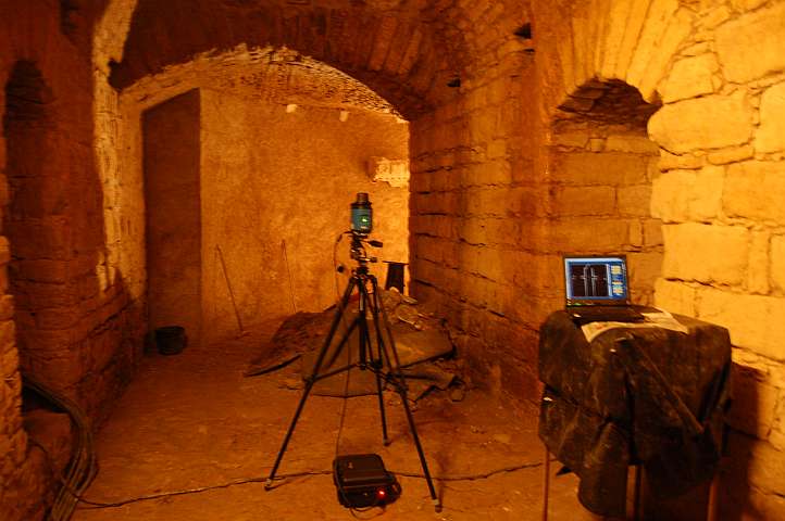
- Virtual heritage
- Ground maintenance inspection
The software is easy and intuitive to use and allows the data analysis on site or the data exportation for detailed analysis on a CAD software.
This product can be purchased or rented. Albatroz Engineering is also available to offer the measurements as a service. For further information, please contact us.
There are two LMT brochures, one related to power line inspections and the other related to construction measurements.

LMT mounted on a tripod

LMT in its protecting case
| Technical specifications | |
|---|---|
| Range | 40 m @ 20% reflectance |
| 100m @ 80% reflectance | |
| Error | < 2cm (all range) |
| Angular resolution | 0,125 |
| Autonomy | > 350 images/profiles |
| Dimensions (w/case) | 330x234x152 mm |
| Mass (w/ case) | 7Kg |
2D Profiling
This solution is aimed to professionals of civil engineering, architecture or topography that need a precise and quick system to measure distances for different type of applications:
- Comparison between projected work and executed work,
- Floor plan update for reconstruction work,
- Roads and tunnels profiling,
- Any type of 2D profiling.
The software is easy and intuitive to use and allows the data analysis on site or the data exportation for detailed analysis on a CAD software.
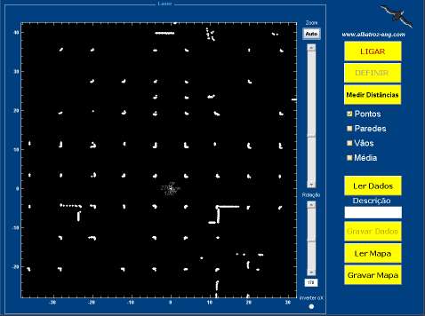
User Interface at an underground parking lot
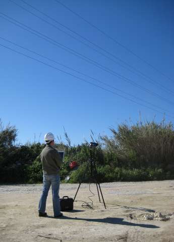
Street inclination (or slope) measurements in Lisbon, Portugal

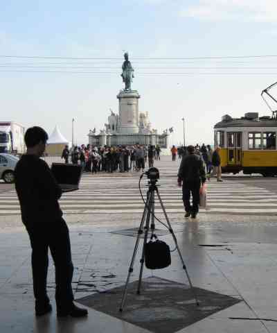
Triumph Arch at Praça do Comércio*, Lisboa, Portugal
*also known as Terreiro do Paço

| ©2014 Albatroz Engineering Inc. All rights reserved. | site map | webmaster |